 |
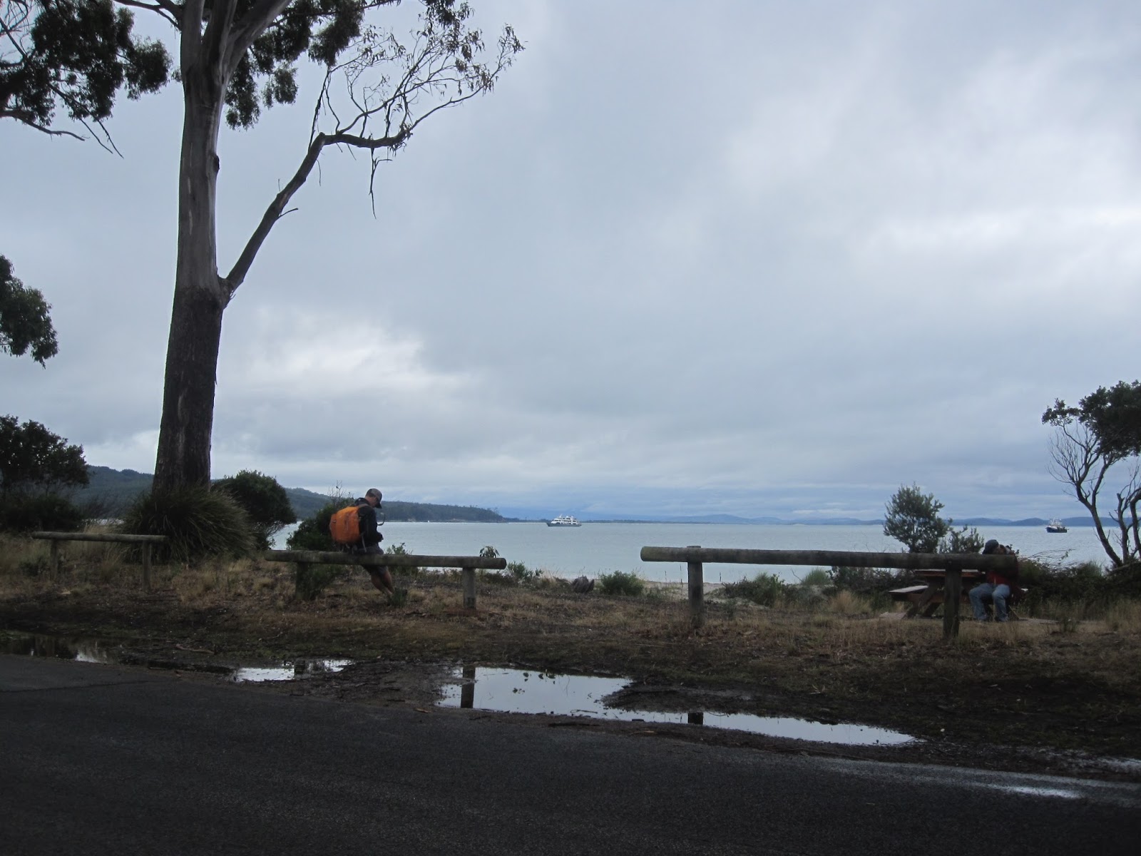
| Waiting for the ferry. It's drizzly but the excitement is palpable |
You could say I went overseas this week. OK, not far - only twenty minutes by ferry, but it was a different world. The ferry leaves from the little seaport of Kettering, about an hour south of Hobart. It's not too expensive at around $38 return for cars and it's free for passengers, but there was still that little frisson of excitement. When I think about Bruny, being an island of an island State and that Bruny itself has islands, it makes me think of Matryoshka dolls or boxes within boxes, bracketed equations or something which quietly does my head in.
 |
| Couldn't help noticing this spider on the car in front |
 |
| The bumper sticker seemed very apt |
Bruny, named after French explorer Bruni D'Entrecasteaux who mapped the Channel in 1792 and 1793, sprawls
along the coast between Kettering and Cockle Creek, almost as far South as you
can go for about 100 kilometres. It is in fact two islands marginally attached by a long
narrow isthmus known as the Neck. In some ways it is a microcosm of Tasmania,
combining many of its key features – physically, historically, culturally, in a
more compact space. It also has a few quirks of its own which I will come to
later.
 |
| Classic view of the Neck |
 |
| And these are the stairs you have to climb to get it. Just left of centre on the beach is the bird hide where you can watch the Fairy Penguins come in at dusk |
As far as the landscape goes, Bruny (permanent population
approximately 800), is hilly and windy with precipitous sea cliffs interspersed
with pleasant beaches and farmland. The vegetation varies from coastal
heathlands, through grassy plains fringed by straggly eucalypts to sheltered
heights, where rainforest flourishes beneath an upper canopy of tall blue gums.
Thirteen of Tasmania’s 14 endemic
birds can be found here as well as large numbers of fairy penguins and short -tailed
shearwaters which can be seen at the Neck at dusk.
There is also a memorial here to the Nuenonne people
who originally occupied the island. One panel is dedicated to Truganini, the last full
blooded Aboriginal and the daughter of a chief. Traditional industries such as forestry, fishing and
farming remain important but are now
complemented by tourism, vineyards, fish farming – both oysters and
salmon, and specialty food producers
such as a cheesemaker, a whisky distiller and a berry farm.
In common with the rest of Tasmania, the sealed road does
not extend far beyond the main population centres and there is little connectivity
between them. Because driving is such hard work – slow because of the hills and
bends and even more so on the unmade roads, it feels and takes a lot longer than
it would appear by looking at the map. I also believe that there’s another
factor at work. I think your sense of scale changes in accordance with the size
of a place. I noticed that first when moving from Victoria to Tasmania. Perhaps
you absorb it from the locals. When I said in Alonnah that I was going to take
a look at Dennes Point that
day and might come back to stay the
night, the lovely woman I was talking to said, “But that’s 33 kilometres away,
you won’t want to come all the way back here.” I used to drive that distance to work every
morning in Melbourne, but as it turned out, she was right.
Also in common with “the mainland” (Tasmania, I mean), the
tyranny of distance means that cost of freight and transport makes most things
more expensive. For example, fuel which was a remarkable $1.21 per litre when I
left home, was $1.59 per litre on Bruny and Cuppa Soup which can be bought for
around $1.00 on special in supermarkets on “the mainland,” was up to $3.30 in Adventure Bay. Water is at
a premium as everyone relies on tanks rather than a central water supply. This means
that the campgrounds run by National Parks and Wildlife provide only a very
limited amount and this must be boiled before use, unless you are staying in
more formal and much more expensive accommodation.
There are no cash machines on the island though more up -market establishments will accept cards and may on rare
occasions give a little cash out with purchases. I found the Post Office at
Alonnah particularly helpful in that regard. Parks and Wildlife do accept
online payments in lieu of cash, but I only had a signal in one place on the
island and that wasn’t anywhere near the National Park. Apart from the three
Campgrounds run by Parks which are a long way from the population centres, and
the Caravan Park in Adventure Bay, there is nowhere to pitch a tent. If you have
an RV which is completely self -sufficient including your own toilet and water,
Alonnah permits parking in the paddock behind the pub for $5 per night.
 |
| This scene hasn't changed much since Cook and Furneaux obtained water for their ships from the Resolution River named after Cook's ship |
Historically Bruny was the place where all European ships
crossing the Pacific called to fill up on wood and water after the long haul from the Cape of Good
Hope. Famous visitors included Abel Janzsoon Tasman in 1642, Marion du Fresne
in 1772, Tobias Furneaux in 1773, Captain James Cook in 1777, Captain Bligh in
1788 and 1792, Bruni D’Entrecasteau in 1792 and 1793, Bass and Flinders in 1798
and Nicholas Baudin in 1802. There are many commemorative signs and markers along
the beach at Adventure Bay, named after Furneaux’s ship. The first specimens of
Eucalyptus were gathered here by Joseph Banks and Adventure
Bay is regarded as the place where European involvement with Australia began. After the explorers came the whalers, the timber -getters and the coal miners.
 |
| I learned much of this at the quaint Bligh Museum which contains a wealth of charts, pictures and information about those swashbuckling seafaring days. It's also a great place to cool your heels while waiting for the morning's" possible shower" to disappear |
 |
| You fully expect to see tall masted sailing ships here, but there's only a 14 person cruise ship |
Today it is tourists. They numbered around 74,000 in 2010/11 and easily
swamp the small population of permanent residents. You can understand them getting a trifle snarky about tourists complaining about the modest facilities or the prices, particularly if they themselves are not the ones profiting from the influx or they may have moved here for the peace and quiet.
While Adventure Bay being more sheltered, has become Tourist
Central and has the only petrol bowser on the Island, Alonnah a quiet little village on the western side
has the only medical centre, a pharmacy,
the Police Station, a Post Office, a school and the only hotel. Its general
store takes a while to discover being set back on a side -street off the main
road. Lunawanna, a little further on, is smaller still, but boasts a winery, a boat ramp and toilet facilities.
 |
| Entrance to the South Bruny National Park - a fretaste of what was to come - wild seacliffs, roaring surf, bizarre rock formations |
After a quick look around all three villages, I head to the South Bruny National Park. It's late in the day now and the weather isn’t exactly kind, but the
scenery is spectacular and I have a feeling that this probably presents a truer
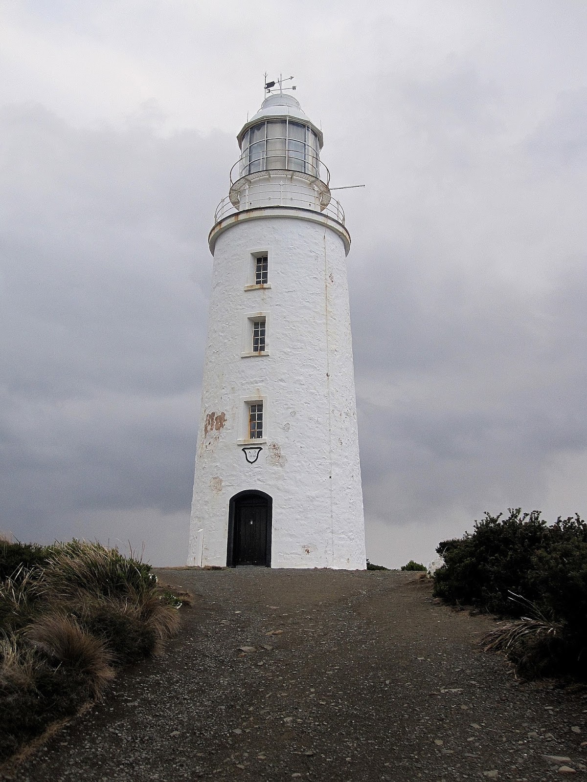
picture of what life is like here much of the time. The Bruny Lighthouse looms
large in the distance. Until Bass and Flinders discovered Bass Strait in 1798
in their epic whaleboat circumnavigation of Tasmania, all shipping between the
Atlantic and the Pacific had to pass this way. There were many shipwrecks,
leading to the building of this light in 1830, the third in Australia.
 |
| Sharklike rocks on approach to the lighthouse |
 |
| I would have preferred the clouds to part - Cecil B. De Mille style for this shot of the lighthouse, but perhaps this presents a truer picture. The views are spectacular |
Comments