 |
| A glimpse of the Walls of Jerusalem, though this photo doesn't even hint at how tall and imposing they are |
I had hoped to post some lovely pictures of waterfalls
today, but alas it was not to be. The first of these lay on the eastern side of the Walls of Jerusalem
- not the famous historic sort, though they probably should be. The “Walls” are a
somewhat mysterious mountain range which lies between Cradle Mountain - its
well -known cousin, and the Central Highlands. While traditionally visited by
hardy bushmen, snarers and mountain cattlemen, the forbidding terrain, the lack
of any kind of services and the difficulty of access, renders it less likely to
be on the tourist itinerary. The road in
itself had been closed for several years after the devastating floods and fires
of 2015 and 2016 and has only recently been reopened. For some beautiful photos of the region check out David Noble's post about same.
 |
| Looking over a deep gorge towards Clumner Bluff (I think!) |
Nevertheless, it harbours some jewels –A string of lakes called King Solomon's Jewels in fact, and Bethesda’s Pool, stands
of ancient pencil pines and an amphitheatre of rock formations which can only
be accessed through gaps called Herod’s Gate or Damascus Gate. The names
alone will convey some of the awe and reverence felt by early European visitors.
I walked there with my sister one
Christmas and remember it well, especially the beautiful wildflowers, but the gruelling
climb to reach them also remains indelibly etched in my memory so I have stayed
well away. [It didn’t help that besides
tent, stove and sleeping bag, I was also carrying our Christmas Dinner, a cast
iron frying pan and a bottle of bubbly].
 |
| Despite the destruction wrought by fire and flood, parts of the forest are making a comeback |
Yesterday’s walk in search of a waterfall aptly billed as
“Tasmania’s best kept secret,” took me along the base of these imposing
ramparts. The road in was so terrible it shook the gas line right off the van’s
gas cylinder* which gave me a bit of a fright when I stopped to make a coffee, and though I walked for six hours and saw
some lovely scenery, I never did find that waterfall.
 |
| The bridge - looking remarkably like the one at Kelly Basin. There is no sign of a track though |
Yes, I wished I hadn’t left my detailed TasMap of this area
in Tullah, where I thought it would be of more use. I wished I had a Garmin GPS. Knowing I would
have no signal in these parts, I had downloaded the relevant sections from
Google Maps to use offline, but they were not detailed enough to show the waterfall
or the several different trails which ran from the main one. I had also taken
three different sets of track notes, none of which agreed with each other or accurately
reflected where the falls were.
The first one said follow the road for two hours and you would
come to some signage indicating that you were now in The Walls of Jerusalem
National Park, after which you go
gently uphill, though the track may be overgrown and indistinct. The second one
did mention that there were “tempting” turnoffs to other tracks, while the last
one said that the track started as soon as you stepped off the broken bridge. There was
no sign of a track there and I ignored the next road to the right because I
assumed it led to the other places described by the second writer. A note on
the usually reliable “Waterfalls of Tasmania” site had also said “head south
from the old carpark,” whereas this track trended more towards the west.
 |
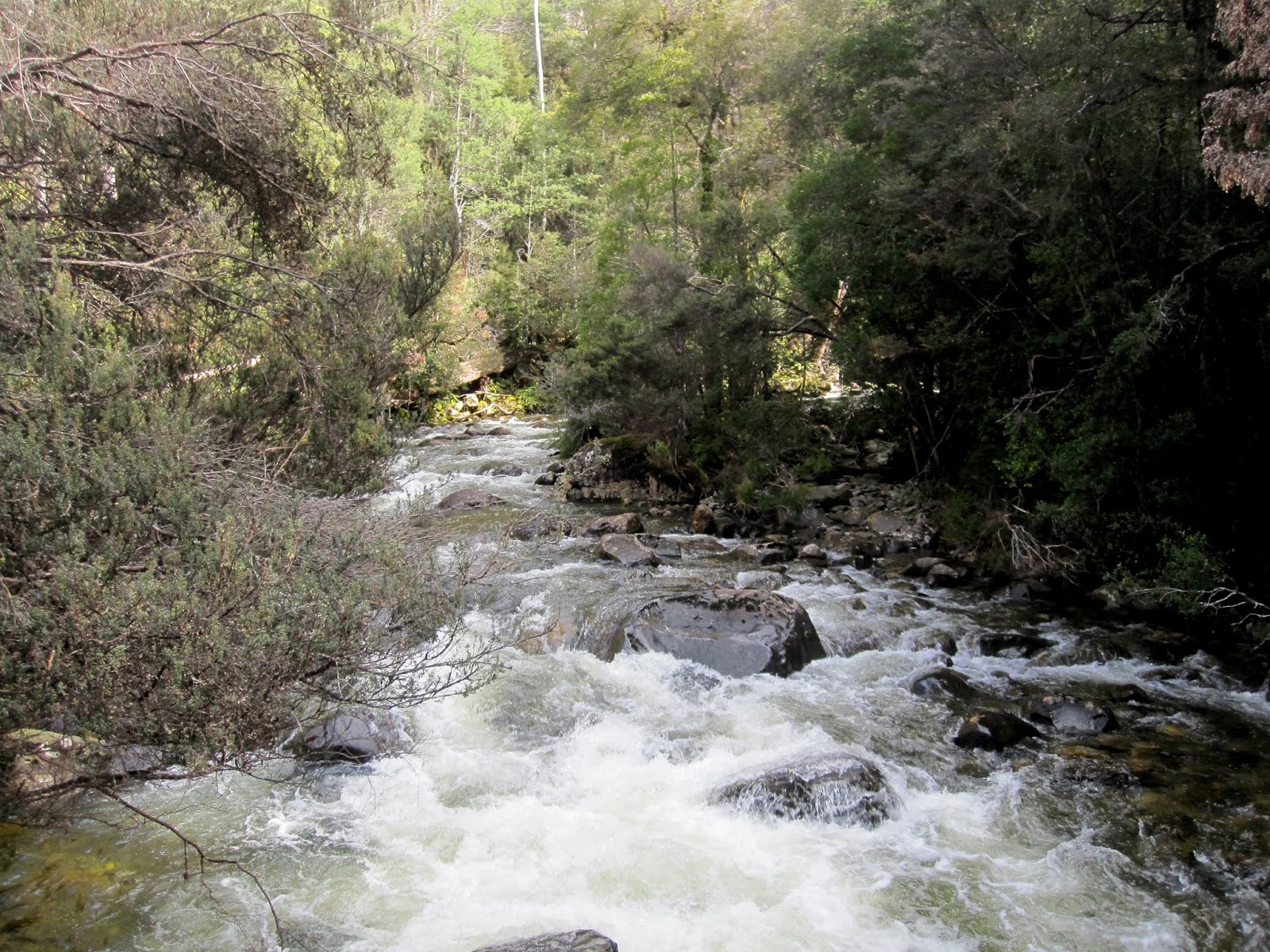
| The river which it spans |
I walked at least another hour or so beyond the old carpark and
explored one track with a broken sign that once said something about Little
Fisher too. I followed this one as well until it lost itself in scrub, and then
returned to the main track until I came to a large fallen wattle. Then I walked back
the way I had come. Just as I reached the old carpark again, I saw a broken branch
at the side of the track with a pink ribbon tied to it and an arrow made of
branches pointing up the hill. Both were
invisible on the way up – the branch arrow had just looked like a normal bit of
fallen timber and the pink tape lay crumpled in a ditch. I’d seen odd bits of
blue tape here and there too but it didn’t seem to mean anything. Could this
really be the one? Or was it perhaps marking one of the other walks?
 |
| "Little Fish..." No, this track didn't lead anywhere either |
By this time I had been walking for about five and a half
hours and was really a bit too tired to start on another mystery walk. Even if
it was the right one, it would take at least another hour and a half to the
start of the track plus an hour of bush bashing to the falls and the same back
again, plus the half hour or so back to the car. It’s good to know one’s
limitations. That’s probably the only
reason I am still around to talk about it. Great was the temptation to stay the night and
try again in the morning, but having checked the weather forecast beforehand, I
knew snow was scheduled for the next three days and the Central Highlands is
not a place you want to be snowed in, unless it’s in one of our more luxurious chalets
with a wood fire, and preferably a friend or two to keep you company.
 |
| I saw this arrow when I was almost back at the carpark. On the way up it just looked like a stick. Could this be the one? By this time I was too tired to find out. |
Yes, I was disappointed but it was still quite a lovely walk.
The mountain views were stunning, the wattles were starting to shed their
golden light and there were some pretty sections of myrtle forest. The Mersey Forest Road, which has only
recently come back into service after its bridges were washed away, is a
revelation in itself with startling gorges, engineering wonders, rushing waters and manmade lakes at every
turn. This part of the road is good – for now at least. It’s when you turn off
onto Dublin Road which you follow for 12 km or so, and then the 5 km of pointy
rocks that are Little Fisher Road, that the problems begin. I would never risk
taking a two wheel drive vehicle along these roads again - not even with truck
tyres, so don’t say you haven’t been warned. “I will be back!” as General Douglas MacArthur
said, but not before I have found a friend with a four wheel drive.
 |
| Arm River, just off the Mersey Forest Road, on the way out |
More daunting still though, was the profound sense of isolation I felt here. Even though I am used to travelling alone, as soon as the sun vanished from view, which was often, it became very cold and you could feel the mountains closing in and glowering down. Seeing devil scats as I was walking made me think that if there were still any Tasmanian Tigers around, this would be the sort of place where they might feel at home. I would not want to be stranded here. Beautiful as Tasmania is, it can be treacherous once you leave the well - groomed tracks of a Mt. Field or Cradle Mountain.
P.S. Next day: Glad I hightailed it home last night. We have had absolutely foul weather ever since
– high winds, sleety rain and we are practically at sea level, so I can't imagine what it would be like in the mountains. What a pity we can’t send some of this bounty to
our poor farmers up north.
* A special thank you to Don Howe (Engineering) of Mole Creek for fixing the gas line.
Comments